|
Summer seems to be flying by. It was a late spring, but is now summer is here in force and I'm loving it! It's light when I wake up, and light when I get home from work, and warm enough to ride a bicycle even in the early morning. Maybe when I retire, I'll follow the summer to South America each fall. |
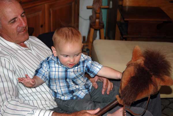
| Barbara had grandkids over for part of a week. She really enjoys that activity, but, wears down quickly. | 
|
|
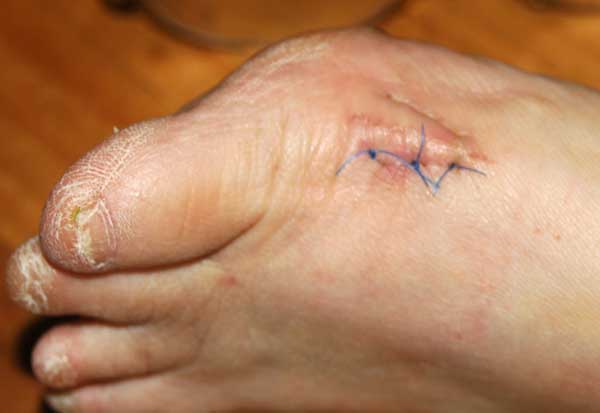
After years of teasing her, it turns out that Barbara really did have a screw loose (at least in her foot). The VA removed it a couple of weeks ago. Her doctor gave her a velcro encased rubber boot and told her to "stay off of your foot," but she remained ambulatory. Yesterday we took out the three stitches. What fun... |
| I have forgotten the details, but a short time ago I played with the settings on my Nikon attempting to capture some arcane effect, and the end result was that it basically ceased functioning. After sufficient procrastination, I downloaded and read parts of the manuel and, as evidenced by this photo, the camera is again functional. I sure used to be a lot better at technology... | 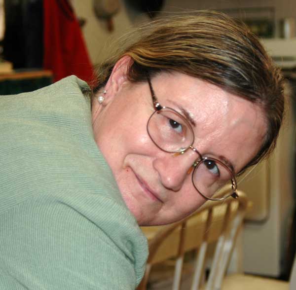
|
|
|
|
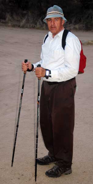
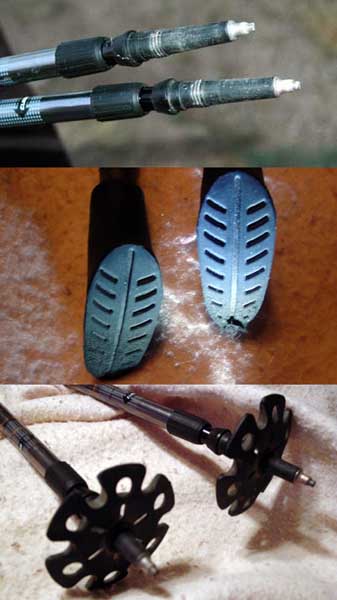
I am still planning on attempting the Grand Canyon later this year, and have undertaken training and conditioning towards that end. I honestly don't know if I can do it, but plan to at least make the attempt. On the short scouting hike Nathen and I took last month, my balance was a major issue. So, I acquired a set of hiking pole (or sticks). I call them crutches, but the nomenclature isn't that important. I have taken them on four outings, and they do seem to help--at least some. They certainly don't take the place of rigorous cardio-pulmonary conditioning, every little bit helps. On our short Grand Canyon hike, we met eight people on the trail, and everyone of them carried a pair of these crutches. In my younger days I would have had volumes to say about them (all of it derogatory), but apparently they are the latest fad and carrying them won't make me unique. Their length is adjustable, and they came with three choices, titanium tips for normal use, rubber tips for pavement (or hiking in the mall according to the salesman), and a small pie plate for hiking in snow or soft sand. I have employed them all and they seem efficacious, although the rubber tips appear to be wearing rather quickly. Crutches in The Canyon... Who would have thought??? |
|
| My plan was to undertake a daily hike along the Oracle Ridge Trail, that ends about 300 yard from my front door, but... those who control the forest had other ideas. | 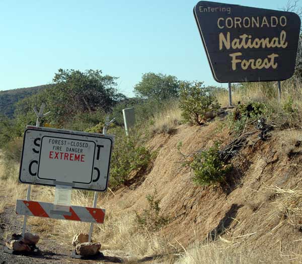
|
|
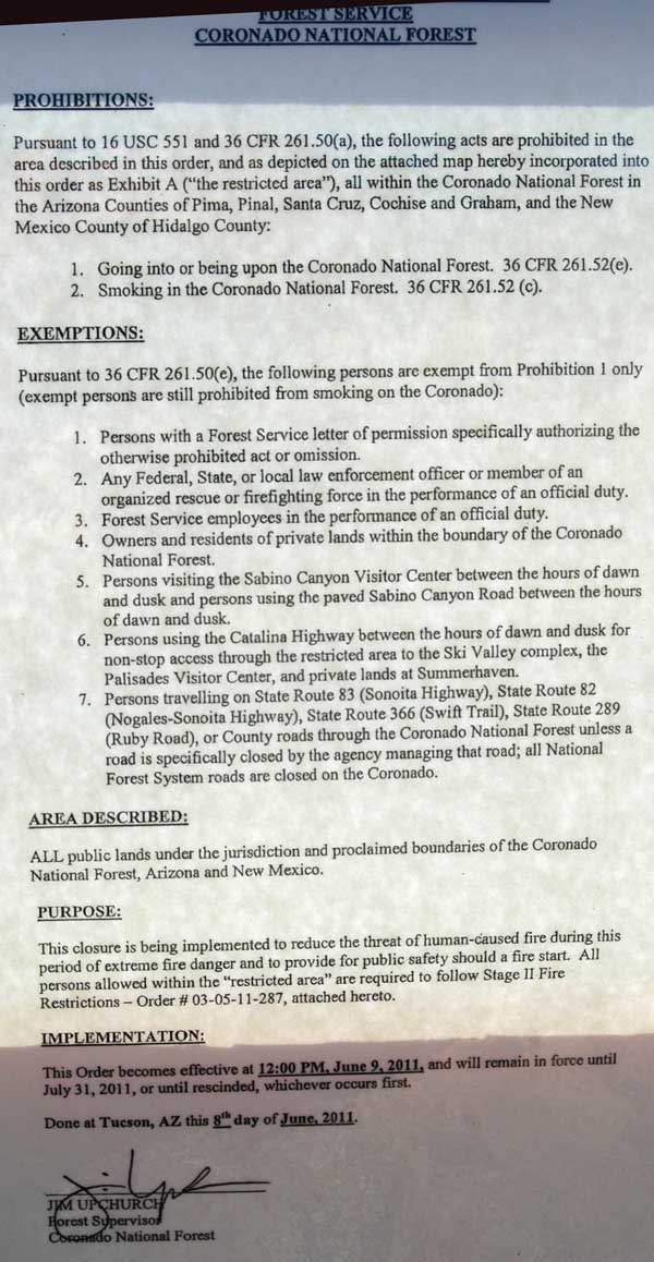
I suppose that in this time of extreme fire danger, when Arizona is burning, care should be taken, and I can see how sparks from the rubber soles of my hiking boots might inadvertently start the next major conflagration... NOT! But petty bureaucrats have to justify their existence, and what better way than by preemptively bullying those who might stray into their fiefdom. |
|
On these "training" hikes, I have carried a GPS and noted the distance and elevation changes. That is kind of a fun toy--I would have like to have had one back in the day... Realistically, I need to be able to walk 10 mile without knee problems to have any chance of making it to Thunder Springs in The Canyon, so we will see how things progress. I'm even considering trying a dietary supplement that claims to enhance joint (cartilage) health (that...in spite of my long held belief that those product are pure quackery). Conditioning sure eats up a lot of my Saturdays. Each of these hikes has started at the same point. Note that the GPS saw the elevation differently each day. I am going to continue posting data from training hikes in this letter. |
| 11 June 2011 | |||
| Time | Distance | Elevation | Average Speed |
| 07:05 hrs | 0 | 4225 feet | ------ |
| 08:05 hrs | 2.3 miles | 4061 feet | 2.3 mph |
| 09:05 hrs | 4.1 miles | 4102 feet | 2.1 mph |
| 10:05 hrs | 5.3 miles | 4206 feet | 1.8 mph |
| 11:05 hrs | 7.2 miles | 4708 feet | 1.8 mph |
| Forest closed, so hiked the Arizona Trail from where it crosses Webb Road to where it intersects Highway 77 (at Tiger Mine Rd), then home via pavement. My knees became problematic circa 5 miles. Bicycled back to the car (3.8 miles). | |||
| 18 June 2011 | |||
| Time | Distance | Elevation | Average Speed |
| 07:16 hrs | 0 | 4241 feet | ------ |
| 08:20 hrs | 2.4 miles | 3975 feet | 2.3 mph |
| 09:27 hrs | 4.1 miles | 4159 feet | 1.9 mph |
| Repeated last Sat. hike, but left motorized bike at the junction of Highway 77 and Tiger Mine Road. Little knee irritation. | |||
| 25 June 2011 | |||
| Time | Distance | Elevation | Average Speed |
| 07:55 hrs | 0 | 4249 feet | ------ |
| 09:04 hrs | 2.7 miles | 3951 feet | 2.3 mph |
| 09:53 hrs | 4.3 miles | 3431 feet | 2.2 mph |
| 10:45 hrs | 6.0 miles | 3259 feet | 2.1 mph |
| 11:10 hrs | 6.5 miles | 3350 feet | 2.0 mph |
| Repeated last Sat. hike, but at the windmill, followed Cottonwood Canyon downhill to Veterans Memorial Highway. Minimal knee irritation. | |||
| 2 July 2011 | |||||
| Time | Distance | Elevation | Average Speed | Temperature | Location |
| 0830 hrs | 0 | 4247/4278 Feet | -- | 95.0 °F | Trail head |
| 0940 hrs | 2.1 miles | 3956/4005 Feet | 2.1 mph | 94.5 °F | Windmill |
| 1057 hrs | 4.0 miles | 4053/4074 Feet | 1.7 mph | 96.8 ° F | Tiger Mine Road |
| 1219 hrs | 6.2 miles | 3568/3667 Feet | 1.7 mph | 99.5 ° F | Power Line |
| 1318 hrs | 7.7 miles | 3301/3398 Feet | 1.8 mph | 99.7 ° F | Vet. Hwy. |
| 7-2-11. Repeated 6-18-11 hike, then hiked down the wash to Veterans Memorial Highway to where I left the motorized bike. Started taking glucoseamine/chondroitin/MSM 7-1-2011. Experienced some slight knee irritation near end of hike . | |||||
| 4 July 2011 | ||||||
| Time | Distance | Elevation GPS/Alt | Average Speed | Temperature | Elevation Change | Location |
| 1127 hrs | 0 | 4237/4297 Feet | --- | 87.2 °F | 0 | Trail head |
| 1224 hrs | 2.7 miles | 3973/4055 Feet | 2.8 mph | 94.6 °F | 429 feet | Windmill |
| 1335 hrs | 4.2 miles | 4037/4156 Feet | 2.0 mph | 97.4 ° F | 1013 | Tiger Mine Road |
| *7-4-11 Repeated 6-18-11 hike, BJH rescued me. Calf muscles sore, but knees not. | ||||||
| 9 July 2011 | ||||||
| Time | Distance | Elevation GPS/Alt | Average Speed | Temperature | Elevation Change | Location |
| 0647 hrs | 0 | 4711/4702 Feet | --- | 81.3 °F | 0 | Oracle house |
| 0816 hrs | 3.5 miles | 4260.4254 Feet | 2.5 mph | 87.0 °F | 160 feet | Trailhead |
| 0850 hrs | 4.2 miles | 4028/3981 Feet | 2.3 mph | 95.0 ° F | 200 feet | pipeline road |
| 0956 hrs | 6.6 miles | 3982/3915 Feet | 2.1 mph | 93.2 ° F | 239 feet | pipeline valves |
| 1059 hrs | 8.2 miles | 3664/3594 Feet | 1.9 mph | 93.3 ° F | 242 feet | church |
| 1143 hrs | 8.9 miles | 3448/3341 Feet | 1.8 mph | 95.0 ° F | 242 feet | Veterans Hwy |
| 7-9-11 Hiked from home to the church via the pipeline road, then to Veterans Memorial Highway where BJH rescued me. Right knee increasingly problematic the last three miles. | ||||||
| 30 July 2011 | ||||||
| Time | Distance | Elevation GPS/Alt | Average Speed | Temperature | Elevation Change | Location |
| 0715 hrs | 0 | 4670/4681 Feet | --- | 81.6 °F | 0 | Trailhead |
| 0757 hrs | 0.8 miles | 5283/5236 Feet | 1.1 mph | 88.3 °F | 577 feet | Junction to little peak |
| 0846 hrs | 2.0 miles | 5143/5091 Feet | 1.3 mph | 90.5 ° F | 639 feet | Road junction below Apachie Peak |
| 0951 hrs | 2.2 miles | 3982/3915 Feet | 0.8(?) mph | 90.2 ° F | 1430 feet | Rock slide |
| 1111 hrs | GPS battery died | -----/5147 Feet | ----- mph | 93.0 ° F | 1532 | Road junction Peppersauce |
| 1207 hrs | " | -----/5223 Feet | ----- mph | 89.2 ° F | 1856 feet | Junction to little peak |
| 1143 hrs | 4.4 (?) miles | -----/4675 Feet | 0.76(?) mph | 93.2 ° F | 1929 feet | Trailhead |
| 7-30-11 Hiked up the Oracle Ridge Trail to the rock slide west of Rice peak. The last distance reading (just prior to the GPS battery failing) doesn't seem reasonable--I suspect it was closer to a mile. My knees hurt on the return trip, but not afterwards. I used a full gallon of water, and was sitll dehydrated the remainder of the day. | ||||||
| 6 August 2011 | ||||||
| Time | Distance | Elevation GPS/Alt | Temperature | Elevation Change | Location | |
| 645 hrs | 0 | 4671/4662 Feet | 81.5 °F | 0 | Trailhead | |
| 0728 hrs | 0.8 miles | 5235/5203 Feet | 90.8 °F | 456 feet | Junction to little peak | |
| 0815 hrs | 2.0 miles | 5115/5055 Feet | 93.0 ° F | 557 feet | Junction road to "Y" camp | |
| 0915 hrs | 2.2 miles | 5939/5783 Feet | 86.9 ° F | 1297 feet | Rock slide | |
| 1032 hrs | 2.7 miles | 6427/6293 Feet | 91.7 ° F | 1745 | Junction rode to Peppersauce | |
| 1157 hrs | 3.1 miles | 6794/----- Feet | 91.4 ° F | 2390 feet | 1/3 way up Rice Peak | |
| 1429 hrs | 3.9 miles | 5915/5954 Feet | 83.0 ° F | 3546 feet | Rock Slide | |
| 1600 hrs | 4.1 miles | 5180/5311 Feet | 93.9 ° F | 3566 feet | Junction road to y camp | |
| 1715 hrs | 4.4 miles | 5253/5416 Feet | 93.2 ° F | 4002 feet | Junction to little peak | |
| 1810 hrs | 4.8 miles | 4676/4858 Feet | 85.2 ° F | 4068 feet | Trailhead | |
| 8-6-11 Hiked up the Oracle Ridge Trail to 1/3 the way up Rice peak. The GPS distance reading seems unreasonable, given that first, the round trip distance was not double the distance to the furthest point, and second, the Trail and Reaction Map of the Santa Catalinas gives a distance of 6.5 miles from the trailhead to a point near Rice Peak where the trail leaves the road, and I estimate I continued up the trail about another ½ miles. The elevation gain also seems unreasonable given the the 1350 foot gain in a section that tended downhill. These toys are fun, but their reliability is questionable. | ||||||