|
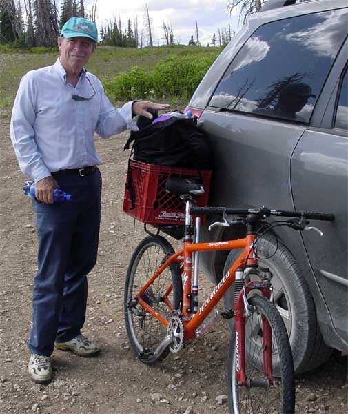
Well, another great adventure slides into the history books. Dave Elliott and I took a mountain bike ride in the Manti-La Sal National Forest located in central Utah. This may seem like an odd activity, but the rational seemed sound. We wanted to do something. My knees don't like to hike down hill, so bicycling seemed indicated. Dave has become heat intolerant, so high altitude (at least in August) seemed indicated. The rest, as they say, is history. |
| Skyline Drive runs from I-70 (exit 86) to Highway 6 in Springville Canyon. We entered from Mayfield and intersected it at 12 mile flat (near the south end), continued north along the remainder of its length, and exited onto Highway 6, traveling a distance of just over 80 miles in three days. That sounds fairly easy, given that it is not uncommon to traverse more than 100 miles on a paved road in a day, but there were "extenuating" circumstances... |
|
|
One of the differences between that forest and local Arizona forests is the lack of posted information. On the entire 80 mile route, we encountered only one sign giving a distance. Perhaps the bureau in charge of that function is staffed by Indians from one of the reservations in Northern Arizona where they believe that if you don't know where you are, you don't belong there. |
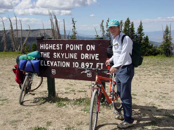
| Our route stayed over 10,000 feet much of the time, and over 9,000 feet until the last 6 miles when we started dropping out of the mountains. I was surprised to learn that sheep ranching is prevalent in these mountains. We encountered several large herds, one of which probably had over 1000. They were on both sides of the road and "baaaed" at us as we rode through. Their voices varied from very high to very low, and just for a moment, I had the impression that Alfred Hitchcock had chosen the wrong animal for his horror movie. |
|

|
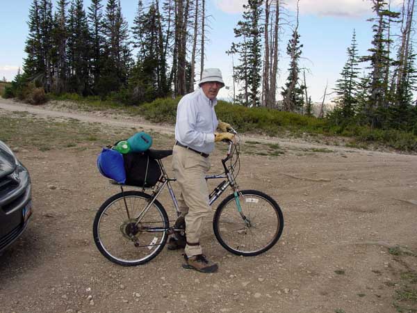
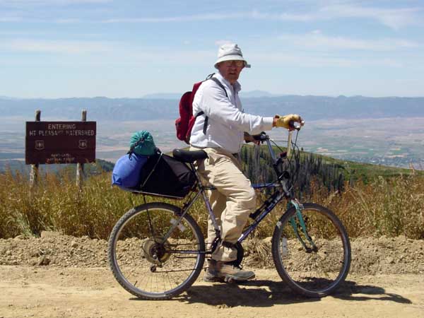
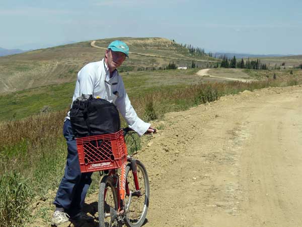
Dave's pack had some advantages. I spent a lot of time packing and unpacking, but he simply dropped his bag into the basket clamped to his rack. Note his rack--it simply clamps on the seat post and has no other support. I think he said it was engineered to support 20 lbs, so he carried some weight on his back. |
| I tried to limit the weight I carried, but still ended up with more than I wanted. My bike weighs 42 lbs and my gear with food, four liters of water, and sleeping gear weighed another 26. I borrowed a sleeping pad from Dave (after my efforts to acquire one on Ebay proved futile), and I estimated its weight as 3 lbs. I didn't weigh the backpack with a map, camera, and other small items. In all, it was sufficient to make pushing the bike up hill (which we did a fair amount) strenuous. The sad truth is that simply being at an elevation greater than 10,000 feet makes lying in the shade strenuous for this old man. |
|
|
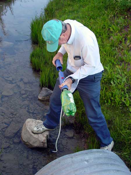
Our water supply proved problematic. The first day I used only 1 liter of the two that I carried but, even though we filled up again with filtered water from a stream, the second day was longer, and hotter so, by the time it was over, we were down to about 1.5 liters between us. |
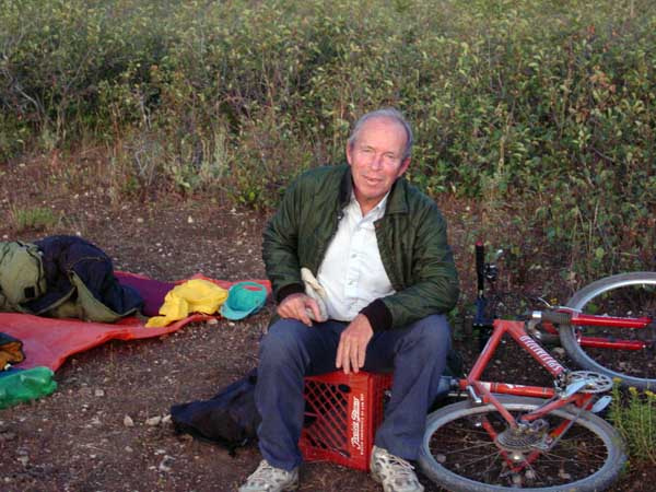
| Then an old sheepherder saved our bacon. We waved him down as he putted along on his four-wheeler, and inquired about any local springs. He gave us the information, but insisted that they were too far down the steep slopes for someone as tired as us (probably not too shrewd a guess, given that our tounges were dragging on the ground at that point). Then he drove back to his camp (a couple of hundred yards away) and brought us some bottled water. It was cold, and very, very good. He was kind of a funny looking old character, but I owe him one. |
|
|
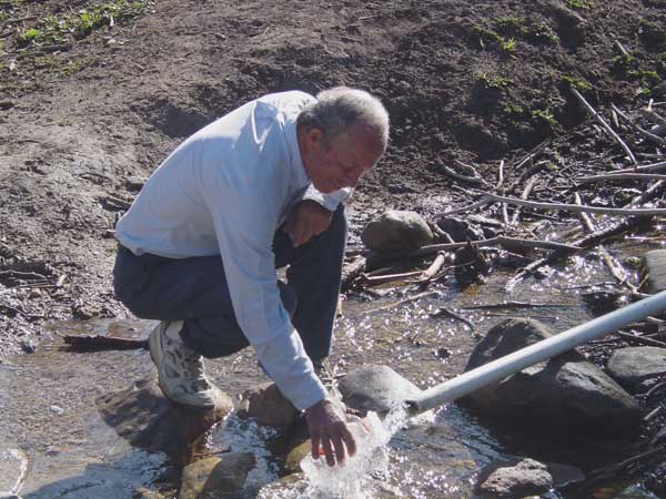
On first half of trip there was running water around almost every curve. The second half was dry for much of its length. We encountered a pipe spring on the last leg, as we were going down to Highway 6. It also had excellent water. |
| We managed to get lost for a short distance. I mis-read my map and Dave's GPS (that is programed to follow trails) lied. So, instead of a downhill, 5-mile, ride on a paved road, we bumped along a rutted lane down to Beaver Dam Reservoir (which measured 80 yards by 30 yards) and then got to enjoy an arduous climb up the other side of the valley. |

|
|
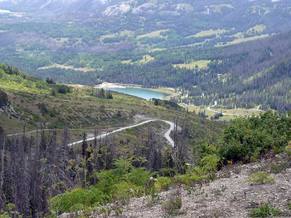
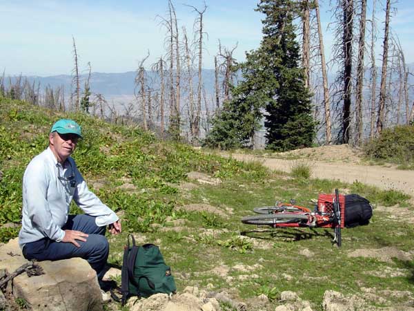
Skyline Drive basically follows the "ridge" for it's entire length. Sometimes this "ridge" is the width of the road (which is passenger car friendly it's entire length) and sometimes it is up to a mile wide with plateaus and meadows. There are lots of scenic overlooks. |
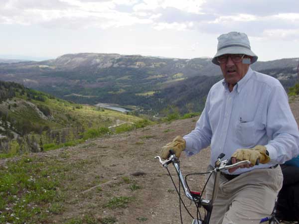
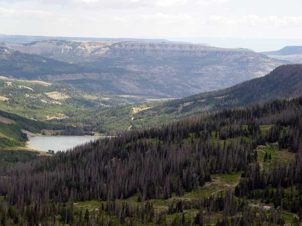
| There are also many lakes and almost every canyon had one... I suspect these function as the water supply for the surrounding settlements. I like the desert, and this was quite different. Still vistas like these can be refreshing (at least in small doses). |
|
|
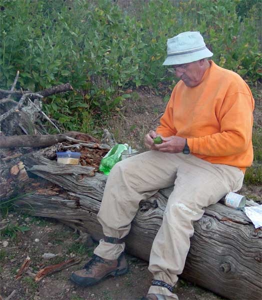
Dave took minimal food. His supply consisted principally of two boxes of Twinkies and four quarts of milk. I, on the other hand, go on these crazy adventures so I can eat. I rarely get hungry other times. I took mostly canned food that required little preperation time (i.e. could be thrown directly in the fire or rehydrated with boiling water). Still, I managed to make cheesecake (minus the crust). |
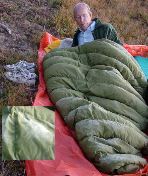
| The first night was a bit cold. Note the frost on Dave's sleeping bag. I slept with my clothes, plus a sweatshirt, sweatpants, and AJ's paint-ball hood. If I had removed my wet socks before retiring, my feet would have gotten warm much sooner. As it was, it took about a couple of hours. Aside from that, I was comfortable, even if it seemed like I didn't sleep much. I am pretty sure I will never try riding this route in February. |
|
|
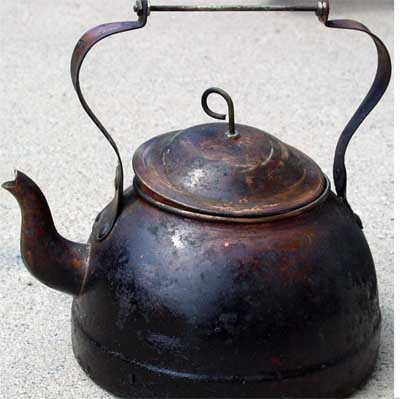
Boiling water over an open fire can be challenging especially if you dislike ash in your food. I solved the problem by taking a small, cheap, copper teakettle and replacing its wooden handles. This sat right on the fire and, although it got black and tar covered, it heated water quickly with very little ash contamination. It probably says something when a person is impressed by their own ingenuity, but I'm not sure what... |
| The condition of the road varied widely. Some of it was what you might expect of a mountain road, and we traversed that part without much difficulty. Much of it is shown on the map as an "improved gravel road." What this meant, was it was graded fairly smooth, then covered with loose rocks ranging in size from a medium cashew up to a large lemon. The maintenance crew had been quite generous with this covering, and in places it was up to four inches deep. This surface was undoubtedly excellent for cars, but difficult for a bicycle. Riding uphill on it was almost impossible, and riding downhill (with any speed) was dangerous! I'm turning into an old woman and Dave (with his front wheel suspension) kept running away from me. |
|
|
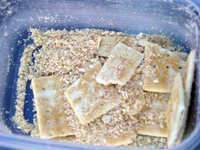
That gravel provided a real "shake down" cusine. It reduced my crackers and Dave's potato chips to dust. Not crumbs, but dust! It also wore several holes in the brand new bag that I used to carry my supplies in. (Not too great of a loss, since I found it alongside the road several days earlier.) We encountered a multitude of 4-wheelers, but they must have been a different type of breed than the ones that inhabit the desert. I have never seen one in the wild here that was traveling at less than 30 mph. The mountain variety all seemed content to putt along between 5 and 10 mph. |
| Historically, Dave and I almost always have mechanical problems on our adventures, but this time the cars and bicycles functioned almost flawlessly. Dave did have a little trouble with his hands, shoulders, and neck from leaning over and looking up while supporting his upper body over his handlebars. My bike looks funny, but sitting in an upright position minimizes the pressure on those body parts. |
|
|
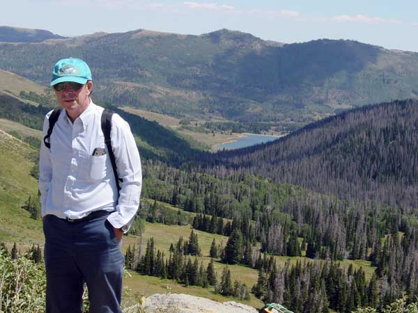
Yawn... Yet another beautiful Mountain Vista... The irony is that we were getting short on water, but the lakes that looked so close would require a half-day of hard riding to get there and back. |
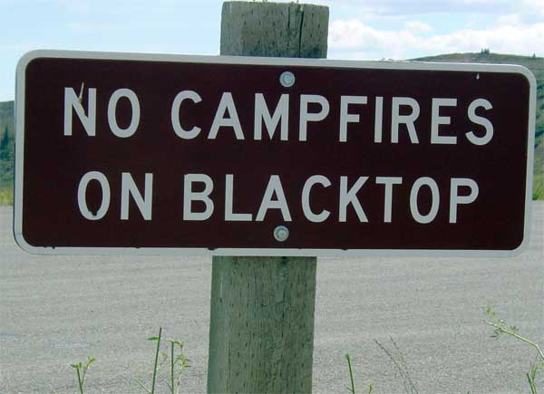
| I enjoy seeing "unusual" signs. Where else but Utah would a bureaucrat think this sign necessary? |
|
|
At our last camp we were worried that we wouldn't make it off the mountain before dark so, we skipped breakfast. At it turned out, we arrived at a point overlooking the construction on Highway 6, about 10 am, riding only 4 hours... It was hard to guess how difficult the travel would be.. |
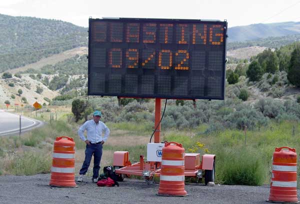
| After we reached the pavement of Highway 6 in Springville Canyon, we had thought to ride part or all of the way down to civilization (it sounded fun, given the steep slope of the land), but construction obviated that as a choice, and so we waited for a ride. As a rule of thumb, road construction is never bicycle friendly. |
|
|
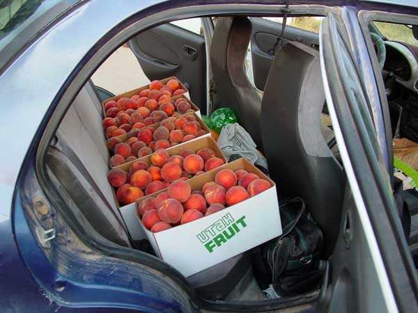
I also brought a few peaches home. Getting them was an adventure in itself, but that's a story for another time. Because of the construction on the eastern route through Moab, I chose to return via the western route through Flagstaff. The little car traversed the 1524 miles without missing a beat, and turned in 45.3 mpg for the trip. That's not too bad, considering that it had a bicycle hanging off its back disrupting the aeordynamics and creating drag. |